Home / Academics / Programs / Outdoor & Environmental Science / EHS Environmental Technician
Students develop core cartographic skills to interpret landscapes, navigate terrain, and study natural environments using maps and spatial data.
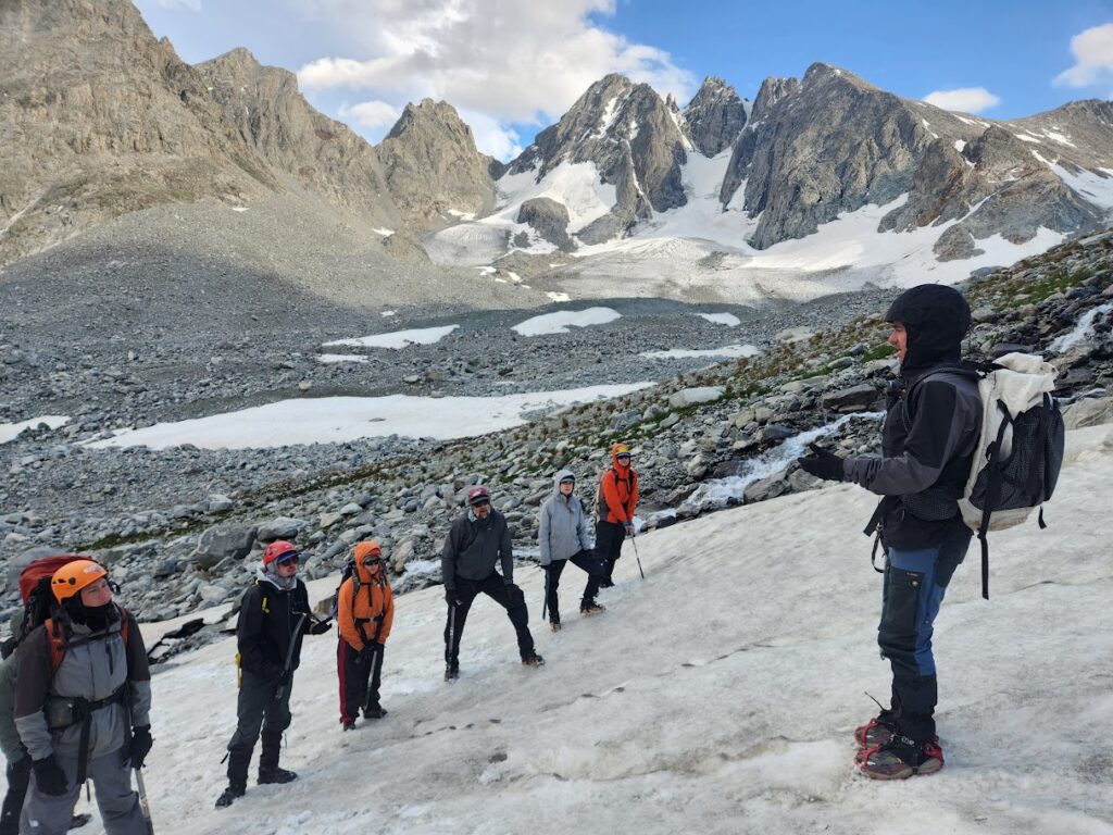
Students apply standard field methods from physical and biological sciences while collecting data in rivers, forests, and other natural systems.
Coursework includes wilderness first aid, navigation, and outdoor skills needed to safely and effectively work in remote environments.
Students learn mobile GIS through hands-on fieldwork and paid internships with industry and community partners.
Students use scientific data collection and analysis to prepare for careers in archaeology, forestry, conservation, wildland firefighting, and wildlife biology.
Students work with professional environmental scientists and agency partners, such as the U.S. Forest Service, to complete professional-quality field research.
Expedition-based environmental data are transformed into reports and maps that are shared with community and agency partners.
Students develop and present undergraduate research posters for academic and professional conferences.
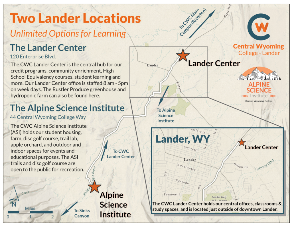
Environmental GIST students live and learn at the CWC Alpine Science Institute in Lander, Wyoming, surrounded by world-class public lands and outdoor recreation opportunities.
The EHS (Environmental Health and Safety) Environmental GIS Associate of Applied Science degree provides the student with a foundation in the natural sciences and a firm understanding of Geographic Information Systems (GIS). The student will complete courses in life, physical, and geospatial sciences while gaining necessary skills to work in remote wilderness environments. General education requirements are designed to encourage the student to develop critical and creative thinking, communication, and writing skills. The geospatial thinking component of the program helps the student develop the skills to effectively collect, map, manage, and analyze data. The foundation gained from this program will prepare the student to address and mitigate complex environmental problems. Employment opportunities in this field are vast and include the energy industry, state government, conservation non-profits, wildlife biology, avalanche forecasting, wildland firefighting, and federal agencies such as the United States Forest Service, Bureau of Land Management, and the National Parks.
The student in this program will complete course work at the CWC Lander Center, CWC Alpine Science Institute, on public lands in the Wind River Mountains and Wind River Basin, and online.
General Education requirements provide students a general knowledge to help them complete a degree at CWC.
| Writing Level I (WR1) | 3 credits |
| American & Wyoming Government (POLS 1000) | 3 credits |
| MATH/APPM/LSCI | (in program) |
| Student must complete six (6) credits of general education courses distributed over two (2) different general education areas, one of which is either WR2 or ORAL. | |
| ARTS/HUM/IT/ORAL/SOC/WR2 | (in program) |
| UNST | 1 credits |
Students in the EHS Environmental GIS program will take classes at our two campuses in Lander, the CWC Lander Center and the Alpine Science Institute.
Students in the EHS Environmental GIS program can receive credit, and professional work experience while participating in backcountry camping expeditions across Wyoming and the world.
If you have an interest in expedition science, environmental science, geospatial information systems technology (GIST), or outdoor education we recommend you live in Lander, WY or in our student housing at the Alpine Science Institute at Central Wyoming College.

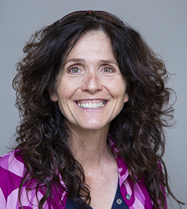
Jacki Klancher has been an educator for more than 20 years. Originally from Patricia, Alberta Canada, Klancher has been at CWC for more than 10 years as a professor and she was integral in launching the Interdisciplinary Climate Change Expedition. This undergraduate research program has allowed her to integrate the classroom component of the EHS Environmental GIST and Expedition Science programs with wilderness travel and adventure.

INSTRUCTOR OF GIS AND EXPEDITION SCIENCE
Mara grew up in Lander, Wyoming and loves finding ways to connect students to their local environments and communities. She teaches GIS, environmental science and geography, and she helps facilitate and teach summer backcountry research expeditions.