Home / Academics / Programs / Outdoor & Environmental Science / Geospatial Science
GIST enables us to see, analyze, and understand patterns on the earth. GIS is crucial for the study of climate change, city planning, scientific research, creating maps, and much more.
Students apply GIST skills and technology in paid internships with local and regional community partners.
Students learn mobile GNSS data collection, GIS software, and the field-based tools and hardware used in GIST work.
Maps and spatial data help GIST students analyze patterns, map hazards, communicate data, and navigate an increasingly complex world.
Learn standard GIS workflows to map and analyze data while preparing for a career in geospatial information science and technology.
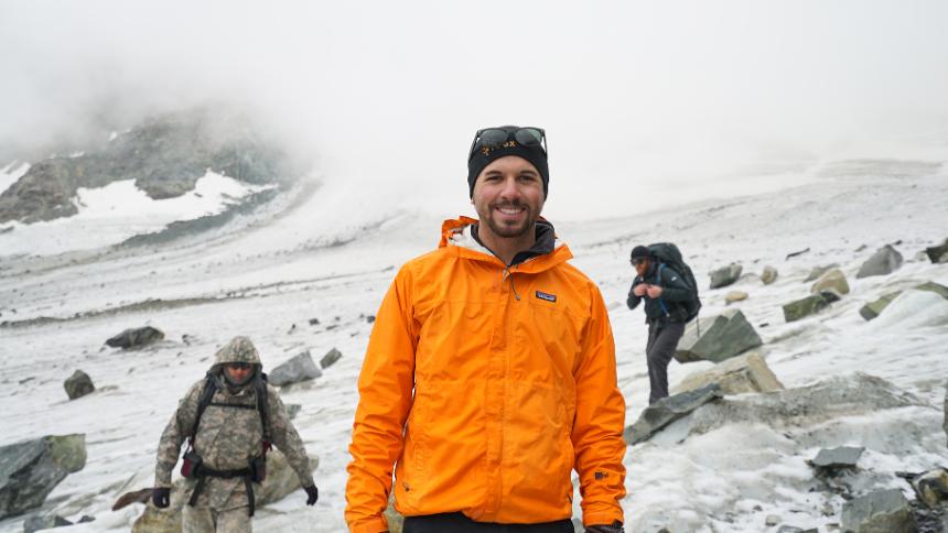
Pair a GIST Certificate with our Expedition Science degree to apply GIS skills in real-world expedition environments.
The Associate of Applied Science degree in Geospatial Information Science and Technology (GIST) is designed for students wishing to gain a background in the field of the collection, analysis and manipulation of geospatial data. Geospatial data is information that identifies the geographic location and characteristics of natural or constructed features and boundaries on the earth. GIST refers to study of the supporting science, hardware, software, and data acquisition skills required to collect and synthesize geospatial data. A geographic information system (GIS) is one form of geospatial technology; global positioning systems (GPS) and remote sensing (RS) are others.
The general education requirements for this program are designed to encourage students to develop skills in critical and creative thinking and to gain the scientific and analytical background required to maximize the potential of geospatial technologies. This AAS degree in GIST prepares students for employment as technicians in the fields of natural resources, government public safety, mapping and utility companies, oil and gas, health and human services, and consulting firms. Students will leave the program with both a theoretical background and hands-on skill set in the field of geospatial technologies.
| Course Number | Course | Credits |
|---|---|---|
| CMAP 1200 | Computer Information Systems | 3 |
| ENGL 1020 | English Composition II | 3 |
| OR | ||
| ENGL 2002 | Technical Writing | 3 |
| GEOG 1020 | Intro to Human Geography | 3 |
| GIST 1200 | Geospatial Foundations | 4 |
| GIST 2110 | Techniques in Cartography | 4 |
| GIST 2310 | Intro to Geographic Information Systems | 4 |
| GIST 2410 | Advanced Geographic Information Systems | 4 |
| MATH 1400 | College Algebra | 4 |
| STAT 2050 | Fundamentals of Statistics | 4 |
| OR | ||
| STAT 2070 | Intro Statistics for the Social Sciences | 4 |
| OEAC 2025 | Wilderness Navigation | 1 |
| Course Number | Course | Credits |
|---|---|---|
| BIOL 1080 | Intro to Environmental Science | 4 |
| ENR 2425 | Mountain Environments | 4 |
| OEAC 2020 | Mountaineering: | 1-5 |
| OEAC 2030 | Wilderness Backpacking: | 1-5 |
| OEAC 2031 | Combined Expeditions: | 1-5 |
| G&R 2032 | Winter Expedition: | 1-5 |
| NOLS Wind River Wilderness Course |
| Course Number | Course | Credits |
|---|---|---|
| GIST 2120 | Geographic Information System Databases | 3 |
| GIST 2125 | Geographic Info Systems Database Apps | 1 |
| GIST 2130 | Spatial Analysis | 4 |
| GIST 2135 | Applied GPS for GIS | 3 |
| GIST 2140 | Survey of Remote Sensing Applications | 4 |
| GIST 2190 | Intro to Programming Geospatial Information Science and Technology | 3 |
| GIST 2395 | Capstone Project in Geographic Information Systems | 3 |
| OR | ||
| CPED 1000 | Co-Op Work Experience I: | 3 |
General Education requirements provide students a general knowledge to help them complete a degree at CWC.
| Writing Level I (WR1) | 3 credits |
| American & Wyoming Government (POLS 1000) | 3 credits |
| MATH/APPM/LSCI | (in program) |
| Student must complete six (6) credits of general education courses distributed over two (2) different general education areas, one of which is either WR2 or ORAL. | |
| ARTS/HUM/IT/ORAL/SOC/WR2 | (in program) |
| UNST | 1 credits |
The certificate I in Geospatial Information Science and Technology (GIST) emphasizes both the academic and technical skills required for the collection, analysis and manipulation of geospatial data. Geospatial data is information that identifies the geographic location and characteristics of natural or constructed features and boundaries on the earth. GIST refers to study of the supporting science, hardware, software, and data acquisition skills required to collect and synthesize geospatial data. A geographic information system (GIS) is one form of geospatial technology; global positioning systems (GPS) and remote sensing (RS) are others. This certificate in GIST prepares students for employment as technicians in the fields of natural resources, government, public safety, mapping and utility companies, oil and gas, health and human service and consulting firms. Students will leave the program with both a theoretical background and hands-on skill set in the field of geospatial technologies.
The certificate II in Geospatial Information Science and Technology (GIST) provides an introductory foundation in the academic and technical skills required for the collection, analysis and manipulation of geospatial data. Geospatial data is information that identifies the geographic location and characteristics of natural or constructed features and boundaries on the earth. GIST refers to study of the supporting science, hardware, software, and data acquisition skills required to collect and synthesize geospatial data. A geographic information system (GIS) is one form of geospatial technology; global positioning systems (GPS) and remote sensing (RS) are others. This certificate prepares students for employment as technicians in the fields of natural resources, government, public safety, mapping and utility companies, oil and gas, health and human service and consulting firms. Students will leave the program with skills and background to complement virtually any profession that requires introductory level skills in the use and application of geospatial technologies.

Jacki Klancher has been an educator for more than 20 years. Originally from Patricia, Alberta Canada, Klancher has been at CWC for more than 10 years as a professor and she was integral in launching the Interdisciplinary Climate Change Expedition. This undergraduate research program has allowed her to integrate the classroom component of the EHS Environmental GIST and Expedition Science programs with wilderness travel and adventure.

INSTRUCTOR OF GIS AND EXPEDITION SCIENCE
Mara grew up in Lander, Wyoming and loves finding ways to connect students to their local environments and communities. She teaches GIS, environmental science and geography, and she helps facilitate and teach summer backcountry research expeditions.
If you have an interest in anthropology, environmental science, geospatial information systems technology (GIST), or outdoor education you can begin your studies and career on top of the Rocky Mountains as part of the Alpine Science Institute at Central Wyoming College.