Integrated Geospatial Information Science and Technology: A National Science Foundation Funded Program Advancing Modern, Field-Based, Geospatial Workforce Pathways
Learn GIST Through Hands On, Wyoming Based Work:
I-GIST is a hands-on geospatial program at Central Wyoming College that prepares students with modern, industry-relevant GIS skills, paid work experience, and direct pathways into Wyoming geospatial science careers.This program is supported by an NSF Advanced Technological Education (ATE) grant focused on workforce preparation. Through field expeditions, applied projects, and internships, students gain hands-on experience collecting, managing, and analyzing spatial data using global positioning systems (GPS), geographic information systems (GIS), and drones while contributing to projects in land management, archaeology, environmental science, and outdoor recreation.
How Our Partnership with the Advanced Technological Education program impacts student lives:
How I-GIST Is Built
I-GIST is designed to support students from first exposure to GIS through workforce entry. The program focuses on:
Modern, industry-relevant GIS skills: Students learn emerging geospatial technologies and high-demand skills, including spatial analysis, web mapping, data management, and drone-based mapping.
Flexible and accelerated formats: Condensed courses, field intensive courses, and alternative delivery formats help students stay engaged, persist, and graduate.
Professional opportunities for teachers and GIST professionals: Targeted professional development helps educators and technicians learn new skills
Strong pathways from high school to college I-GIST supports dual-enrollment and early college pathways, helping students begin GIS coursework alongside their high school programs.
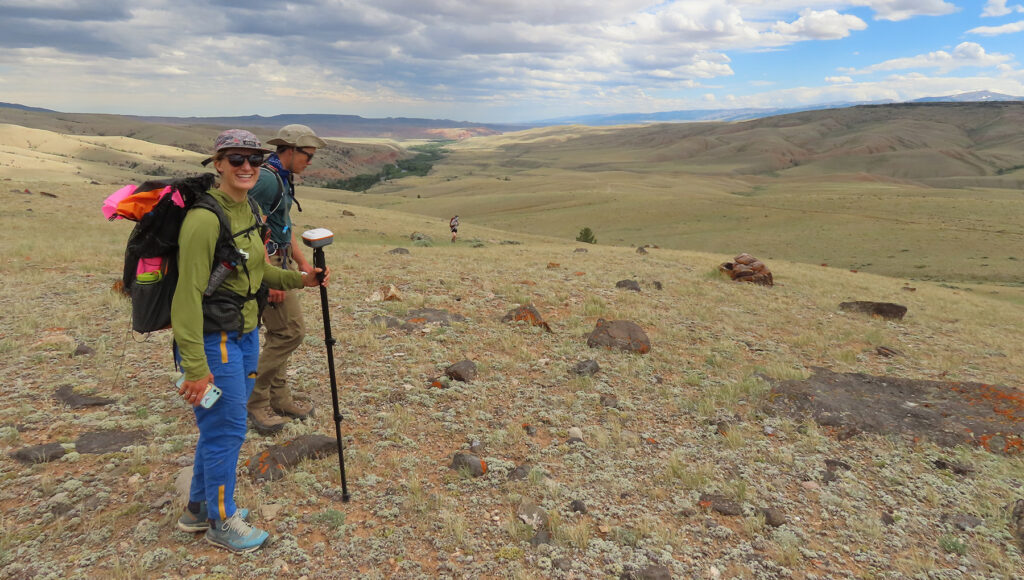
Paid, applied experience Students can access paid internships and research opportunities with federal land management agencies, outdoor recreation groups, Tribal partners, and industry organizations.
Place based, interdisciplinary learning Our strength at the CWC Alpine Science Institute lies in integrating classroom content and activities with memorable field expeditions that enhance student understanding. Our curriculum is rooted in locally relevant issues and Wyoming landscapes.
Figure Caption: Image on Right: Students learn the geology of glaciers from Mountaineering Instructor Darran Wells. Image on Left: back in the GIS classroom, students continue their education by mapping satellite images of glacier change.
Program Pathways
I-GIST works closely with agencies, Tribal partners, land managers, and community organizations to design meaningful projects based on collaborator needs and workforce priorities. All field activities are conducted in coordination with our partners and follow required permitting and land-use regulations.
The examples below provide insight into the types of projects and partnerships I-GIST has supported and aims to continue developing.
HIKES – Holistic Integration of Knowledge and Experience in Science
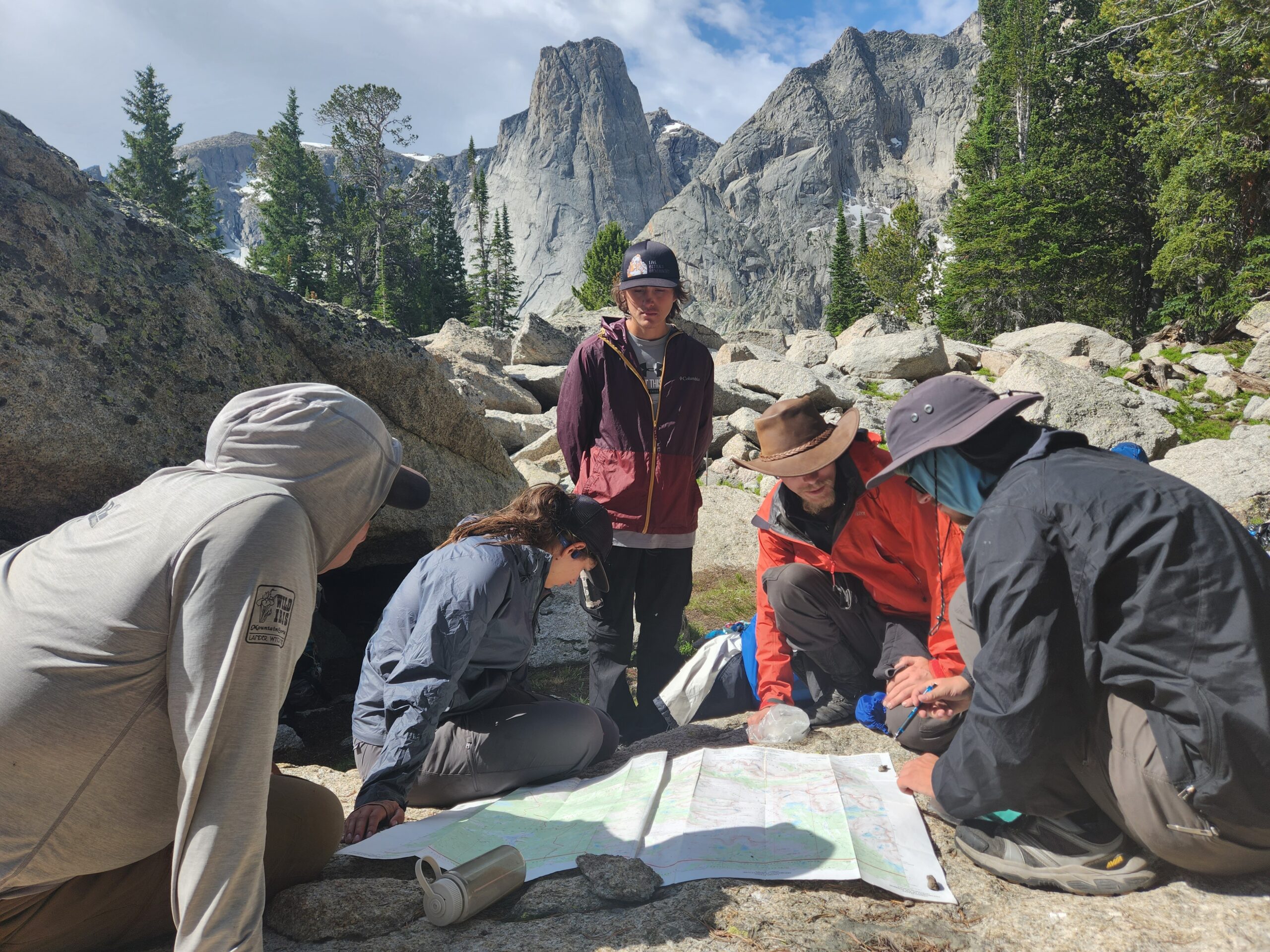
HIKES blends GIS coursework with multi-day wilderness expeditions in Wyoming’s mountains. Students collect and analyze spatial data while working on real projects related to wilderness monitoring, recreation impacts, and land management.
HIKES involves:
Preparation – Students learn: GIS fundamentals, field methods, and project design.
Field Expedition – Students practice data collection using GPS and mobile GIS while learning how to backpack, exploring the Wind River Mountains, and building stronger connections with their peers.
Analysis & Communication – Students develop maps, analyze data, and generate reports and posters for partner organizations.
Students leave HIKES with strong technical skills, leadership experience, and a portfolio of applied work. And they have fun!
Students use technical geospatial skills to navigate in the Wind River mountains while working for the United States Forest Service
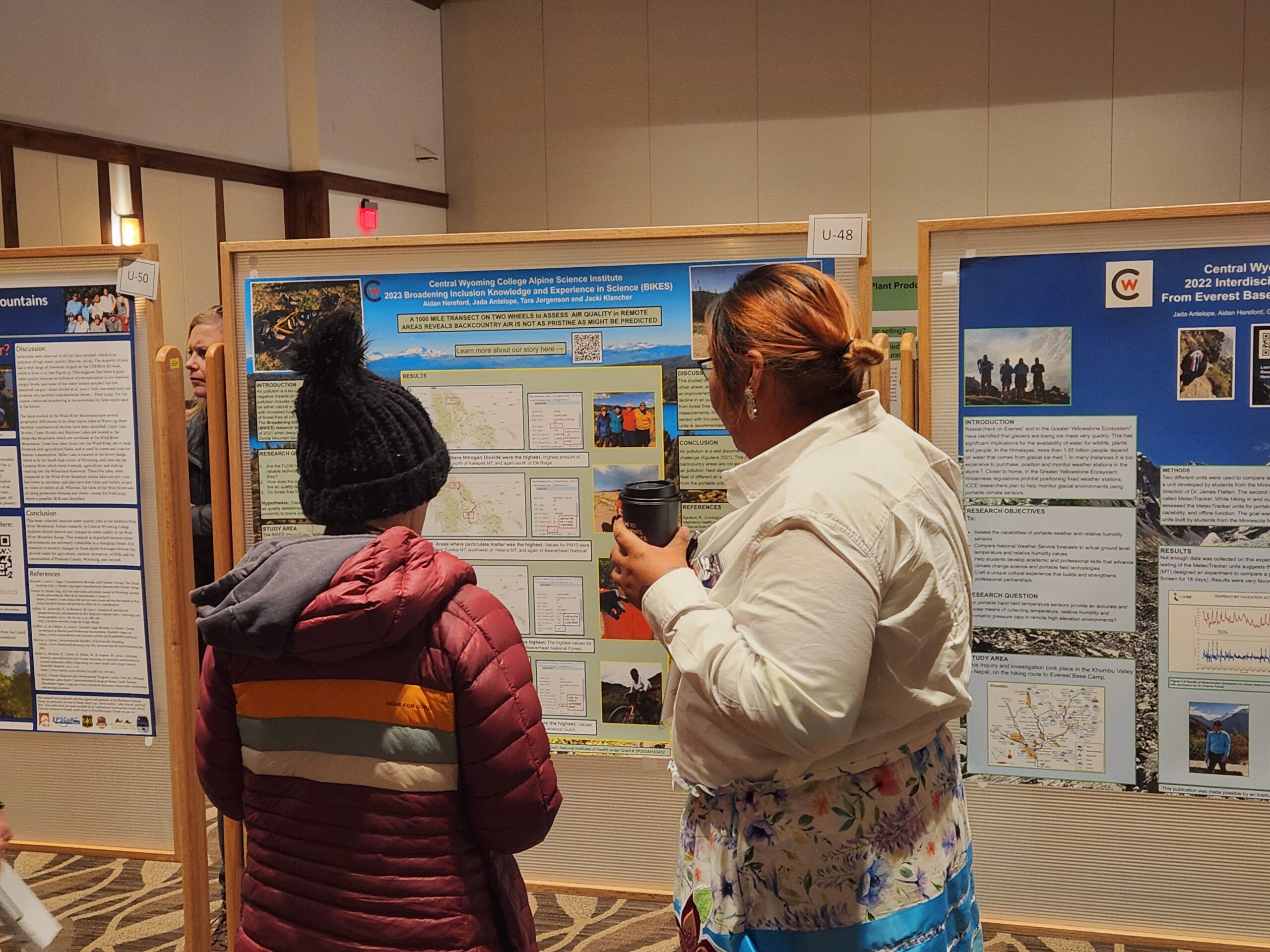
Students share their findings at conferences across Wyoming.
Archaeology & Cultural Resource Pathway
CWC archeology expeditions combine GIS coursework with archaeological field schools across Wyoming – from the foothills of the Wind Rivers to high-elevation alpine sites in the Greater Yellowstone Ecosystem. Students use geospatial tools to design surveys, document sites, and manage spatial data connected to cultural and historical resources.
Student Research & Paid Internships
I-GIST supports paid, applied research and internships in areas such as:
Wetlands and landscape monitoring
Outdoor recreation & trail building
Cultural and natural resource management
Examples of previous student work can be found here:
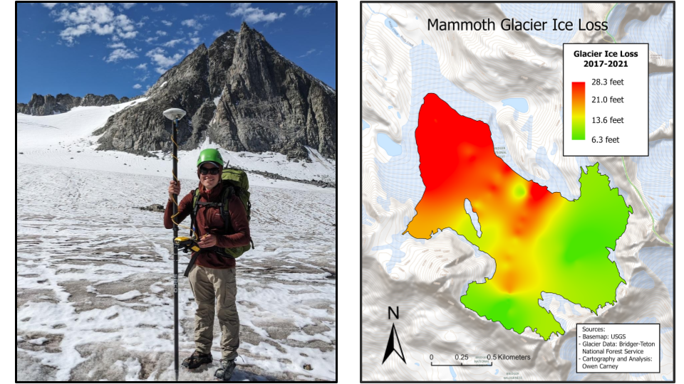
Left Image: Student Owen Carney participated in an internship with the Bridger Teton National Forest, Right Image: Back in the GIS Lab, Carney built upon his field work to map changes in the depth of the Mammoth Glacier.
Want to get involved with the I-GIST Program?
Apply Today, and select one of the following as your area of study:
Geospatial Information Science and Technology (GIST)
Professor of Environmental Science and Health;
Director of Instruction and Research at the Alpine Science Institute;
Agriculture
Jacki Klancher has been an educator for more than 20 years. Originally from Patricia, Alberta Canada, Klancher has been at CWC for more than 10 years as a professor and she was integral in launching the Interdisciplinary Climate Change Expedition. This undergraduate research program has allowed her to integrate the classroom component of the EHS Environmental GIST and Expedition Science programs with wilderness travel and adventure.
Mara grew up in Lander, Wyoming and loves finding ways to connect students to their local environments and communities. She teaches GIS, environmental science and geography, and she helps facilitate and teach summer backcountry research expeditions.
Outreach Director for CWC Lander and the Alpine Science Institute
Kathryn Primrose is the director for CWC Lander and the Alpine Science Institute where she oversees all operations, including student housing at the Alpine Science Institute.